You are here :
Home Filariasis Monitoring Visualization System
|
Last Updated:: 23/02/2012
Filariasis Monitoring Visualization System
- Filariasis Monitoring and Visualization System (FMVS) uses the datasets that are being prepared by IICT & NRSC along with the spatial data.
- The overall objectives of FMVS (Filaria Monitoring Visualization System) include
- To store, organize and filariasis data in a spatial environment.
- To view and query the database.
- The FMVS was designed as an operational system as per the users requirement.
- It consists of user friendly Graphical User Interface (GUI) to visualize the Geo spatial database and query the attributes available.
 |
.JPG) |
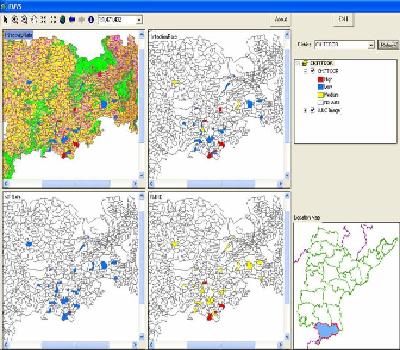
| Spatial map showing the village level prevalence of filariasis (Infectivity, Infection, MF rate and PMH) in Chittoor district of Andhra Pradesh |
Spatial map showing the village level prevalence of filariasis (Infectivity, Infection, MF rate and PMH) in Karimnagar district of Andhra Pradesh |
 |
 |
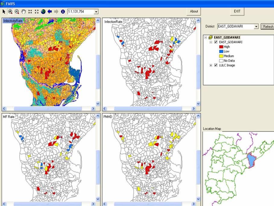
| Spatial map showing the village level prevalence of filariasis (Infectivity, Infection, MF rate and PMH) in East Godavari district of Andhra Pradesh |
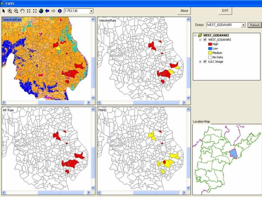
Spatial map showing the village level prevalence of filariasis (Infectivity, Infection, MF rate and PMH) in West Godavari district of Andhra Pradesh |
ONE DAY WORKSHOP AND DEMONSTRATION OF DATABASE ON FILARIASIS AT KARIMNAGAR, CHITTOOR, EAST & WEST GODAVARI DISTRICTS OF ANDHRA PRADESH